A Bartele Gallery CollectionLangweer · Jakarta

American Maps & Prints
Original antique maps, charts & prints of the Americas ★ Originals only


Home › Latin America › The Guianas
Suriname Indigenous People & Tribal Objects - Ethnographic Lithographs 1888
1888 · Maps

Suriname Indigenous People & Tribal Objects - Ethnographic Lithographs 1888

$490
€440 · dollar price at today's exchange rate

Buy now Ask a question

Shipping to the United States: $51 standard, $73 express, insured and tracked.

Date
1888
Kind
Maps
Size
28 × 19 cm (11 × 7.5 in)
Condition
Good. All three original lithographs are in very good antique condition. Even overall age toning consistent with late 19th-century paper. Minor scattered foxing, mainly confined to the outer margins. Images remain clean and well preserved.
Period
The Gilded Age
Places
The Guianas
Reference
BG-14171-10, -11, 12
What the condition grades mean
Excellent
Bright and clean, with no faults worth mentioning.
Very good
Only light signs of age, such as faint toning.
Good
Normal signs of age for a sheet of this period: toning, some foxing, small marks or neat old repairs.
Fair
Clear faults such as staining, tears or repairs, priced to match.

Every fault we see is written in the condition note, and the whole sheet is shown uncropped in the photos.

Guaranteed original. This is an original of the period stated, not a later reproduction or print-on-demand copy. If it is ever shown to be otherwise, we refund you in full.
Shipping to the United States. Sent from our gallery in Langweer, the Netherlands, flat between boards or rolled in a tube, and fully insured. Delivery and import charges.


About this piece

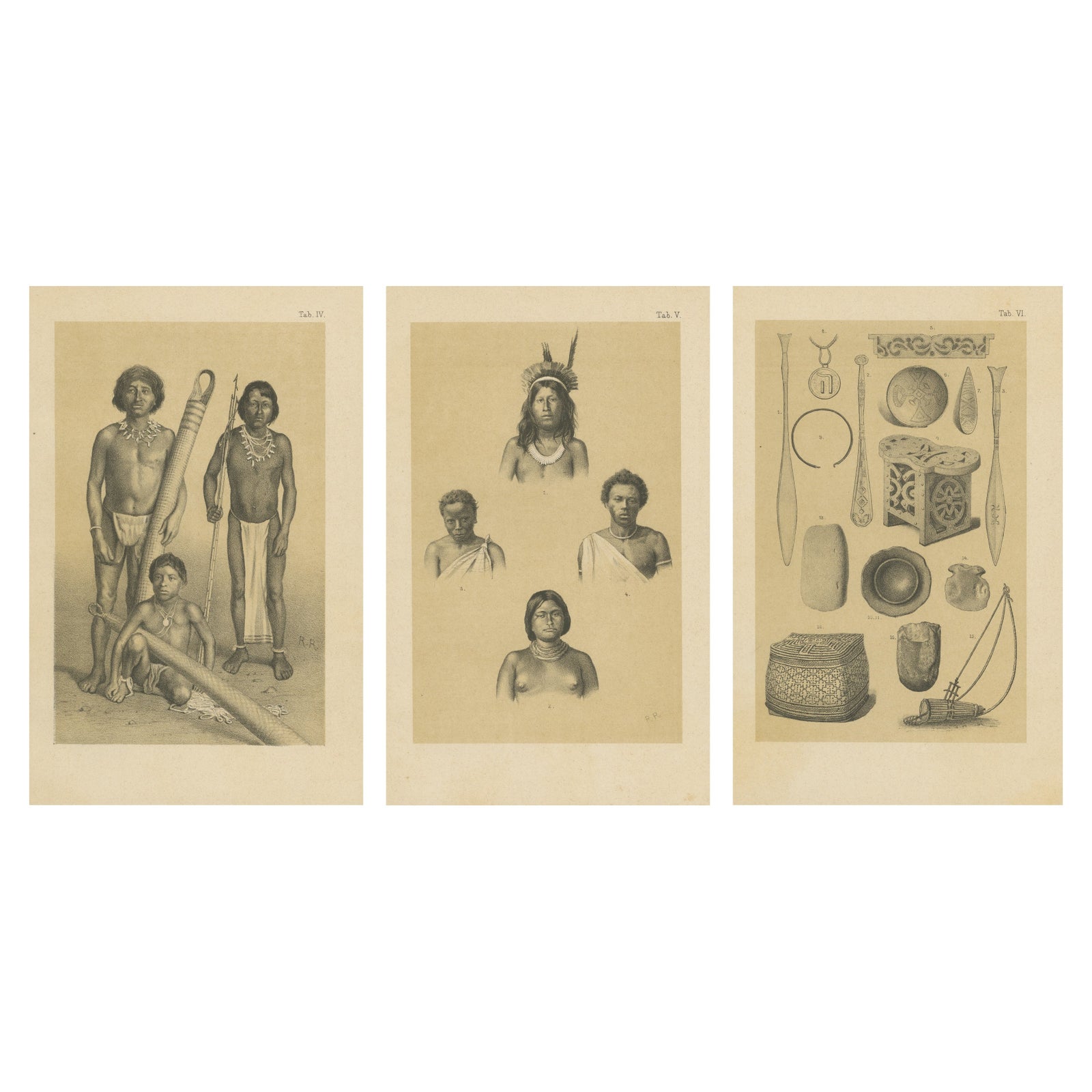
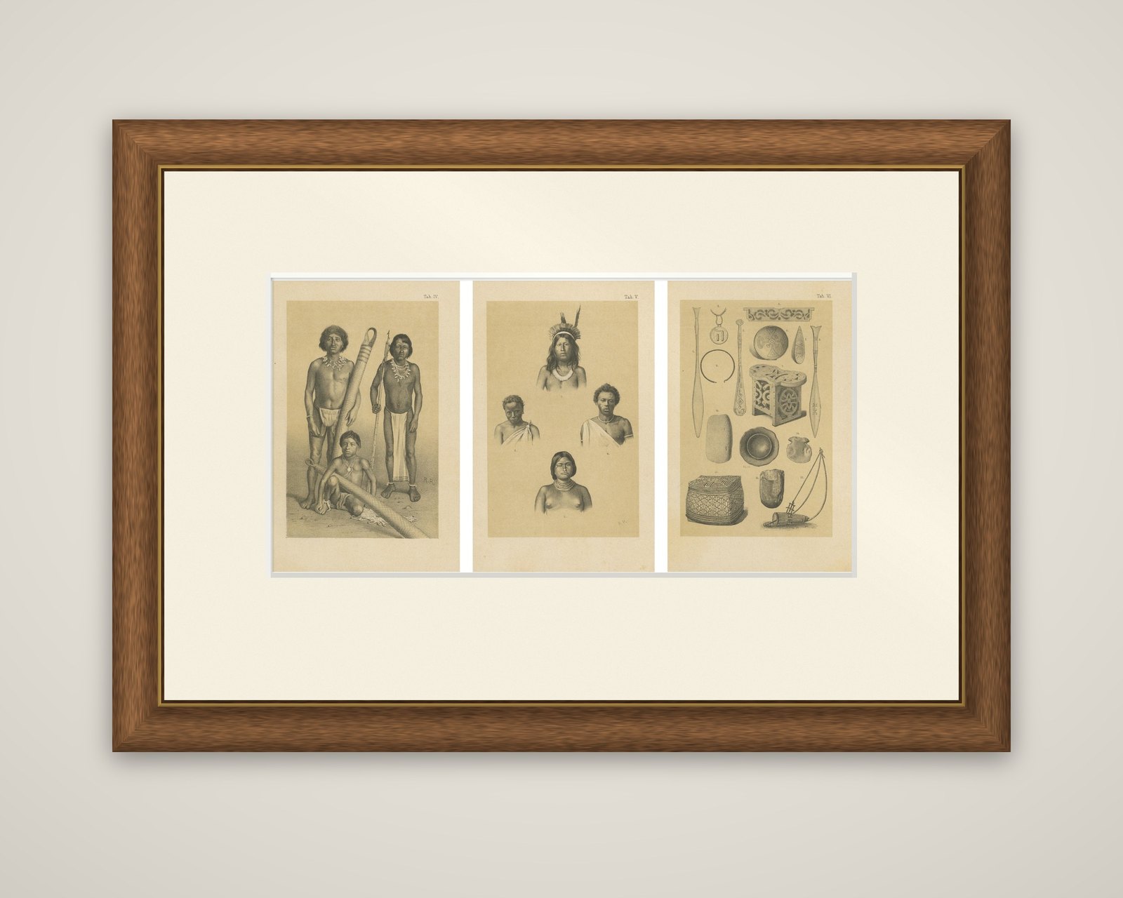
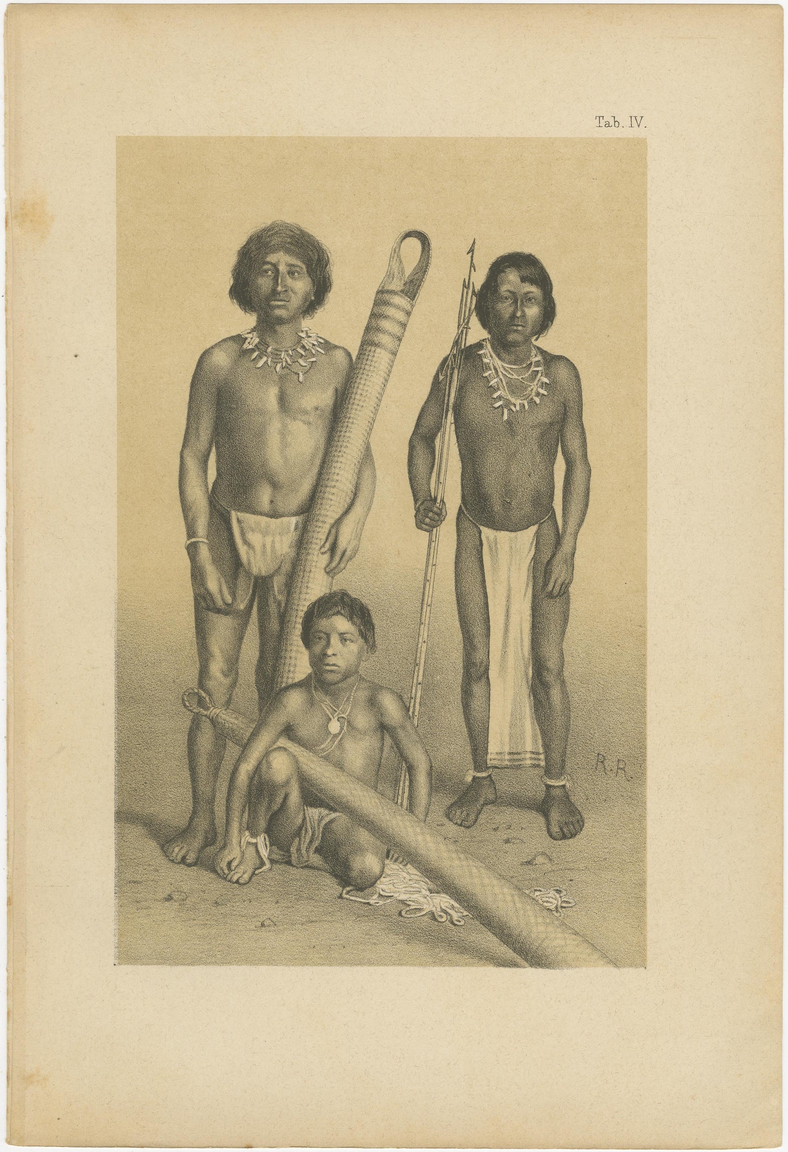
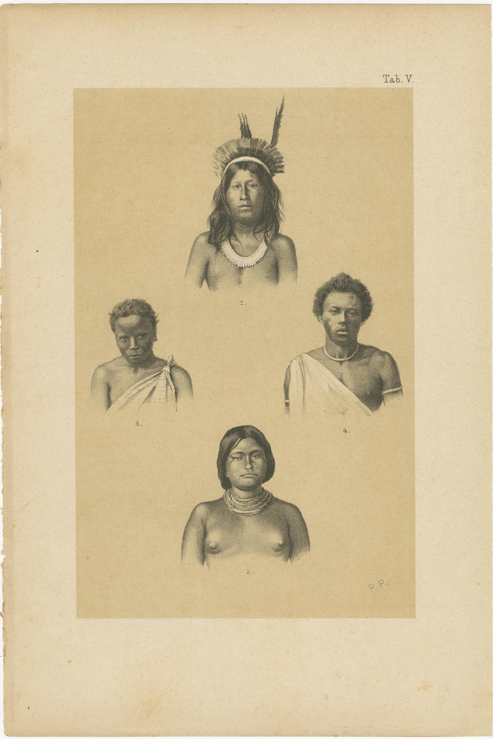
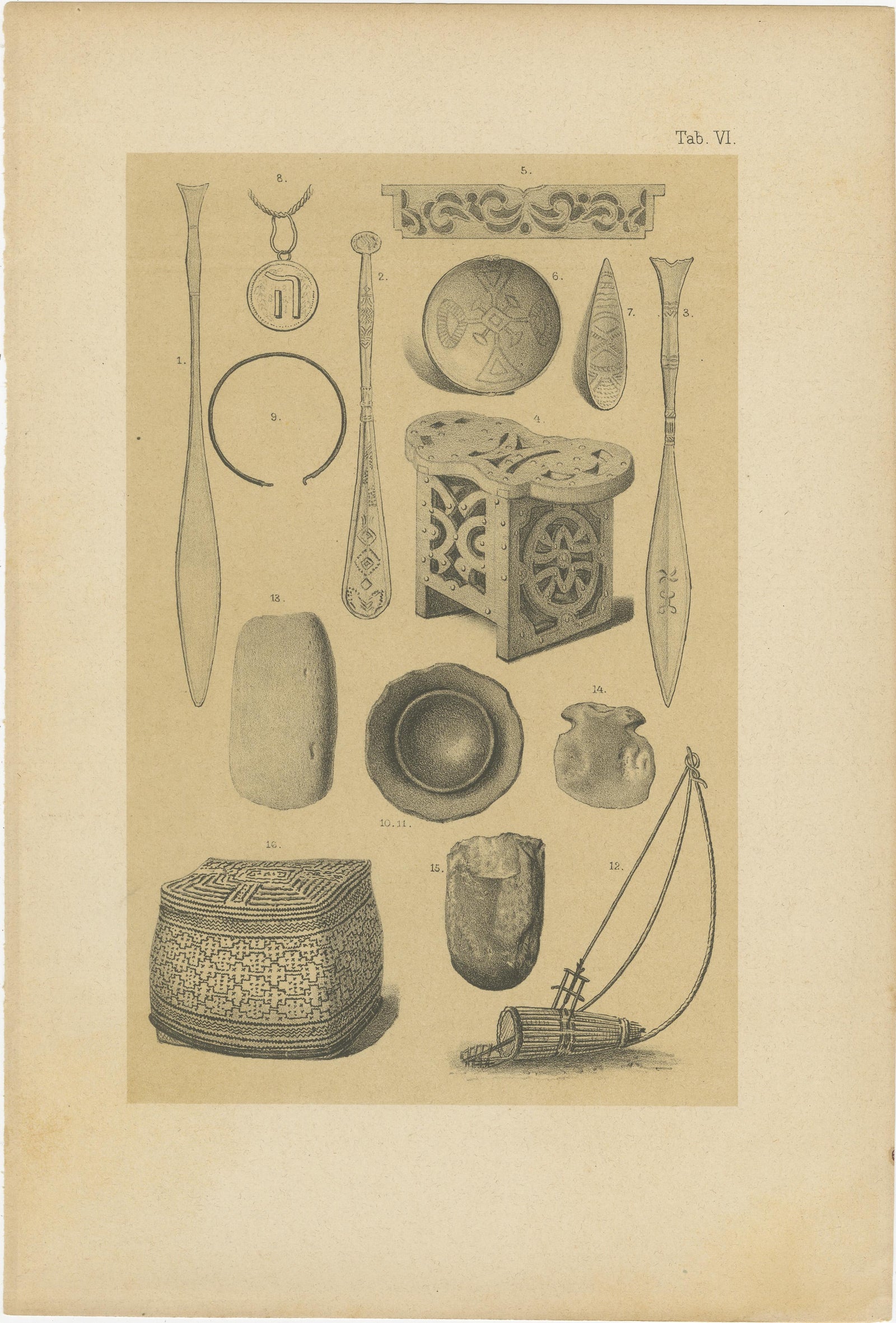
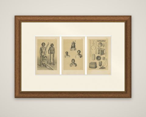
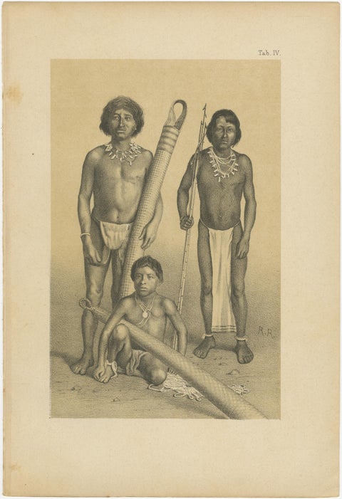
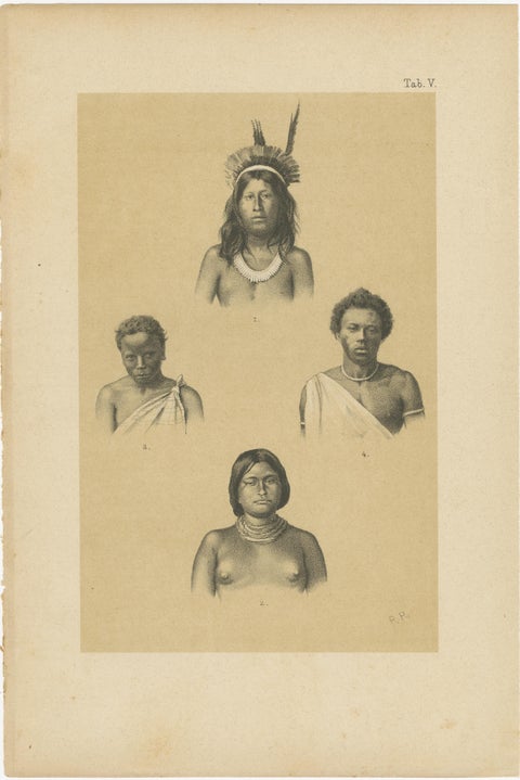
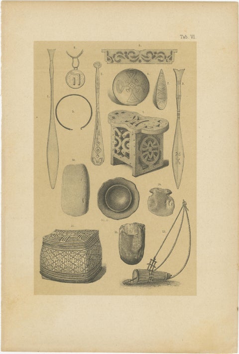
Indians and material culture of Suriname, a set of three original lithographs from Karl Martin's Bericht uber eine Reise nach Niederlandisch West-Indien, published at Leiden by E. J. Brill in 1888. The plates are lettered "Tab. IV", "Tab. V" and "Tab. VI" at the upper right and are printed in gray on a warm buff tint.

Tab. IV shows three people from the interior at full length: two standing men in loincloths and bead necklaces, one holding a long spear, and a seated boy in front of them, with a long banded cylinder lying across the foreground. Tab. V gives four head-and-shoulder portraits of individuals, with feathered headgear on the figure at the top and beaded necklaces on the others, arranged around the sheet. Tab. VI is an inventory of numbered objects: long carved paddles, a decorated stool, bowls and a small pot, a woven basket with a lid, a stone axe head, ornaments and a stringed instrument with a bow.

Martin was a professor of geology at Leiden, and his report on the Dutch West Indies covered the people and the objects he met on his journey as well as the rocks. The old description of the set speculates about which peoples are shown; the plates themselves carry no such identification.

★

You might also like


Antique Map of the West Coast of South America with Costume Figures, circa 1860
circa 1860
$610
Antique Map of the Brazilian Coast with Rio de Janeiro Province, circa 1860
circa 1860
$325
Antique Map of South America with the Falklands and South Georgia, 1858
1858
$270
Antique Map of South America, with the Amazon Basin, Rand McNally, 1899
1899 · Rand McNally
$330
Antique Map of Central America, with Proposed Nicaragua Canal, 1899
1899 · Rand McNally
$385
Antique Hand-Colored Map of Chili by Willem Blaeu, 1658
1658 · Blaeu
$1,435
Map of South America 1792 by Elwe – Hand-Colored Antique Dutch Engraving
1792 · Guillaume Delisle
$1,905
Antique Map of South America ‘North’ by A.K. Johnston, 1865
1865 · W. & A. K. Johnston
$310

Ask about this print

We reply by email, usually within one working day.

Your favorites

Saved in this browser. Email the list to yourself to keep it on any device.

We use your email to send this list and, only if you tick the box and confirm, for occasional new arrivals. Every email has an unsubscribe link. Bartele Gallery, the Netherlands.

Your bag

Total

Each piece is bought on its own; shipping is added at checkout.





